





Vela Maps Emerges as a Formidable Open-Source Challenger to Google Maps, Prioritizing Privacy and User Control

The digital navigation landscape, long dominated by tech giants, is witnessing the rise of compelling open-source alternatives. Among these, Vela Maps is positioning itself as a significant contender to Google Maps, particularly for a growing segment of users who prioritize privacy and operate de-Googled Android environments. This nascent application leverages the robust data of OpenStreetMap while strategically integrating elements of Google Maps’ user experience, aiming to provide a familiar yet distinctly independent navigation solution. Its emergence highlights a broader trend in technology where user control over data and system independence are increasingly valued, challenging the ubiquitous presence of proprietary services.
The Genesis of a Privacy-Centric Navigation Solution
For many Android users, Google Maps has become an indispensable tool, offering unparalleled data richness, real-time traffic updates, and a comprehensive ecosystem of local information. Its utility spans commuters, travelers, and businesses, making it an almost unrivaled experience. However, this dominance comes with certain prerequisites and privacy implications. Google Maps relies heavily on Google Mobile Services (GMS), a suite of proprietary Google applications and APIs that are intentionally absent from privacy-focused Android ROMs like GrapheneOS. This dependency renders Google Maps effectively unusable for a significant portion of the "de-Google" community, who actively seek to minimize their digital footprint and reliance on Google’s data collection practices.
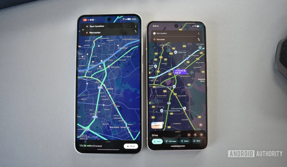
Vela Maps was conceived precisely to address this critical gap. Its developer engineered the application with a core philosophy: to deliver a Google Maps-like experience without the inherent GMS dependency. This approach not only caters to the technical constraints of de-Googled devices but also aligns with the privacy values of users wary of extensive data tracking by large corporations. By offering a functional, intuitive mapping solution that respects user autonomy, Vela Maps directly challenges the notion that comprehensive navigation must be tethered to a Google account or its services. The deliberate design choice to mimic Google Maps’ interface aims to reduce the learning curve and improve workflow for users accustomed to the market leader, providing a sense of familiarity without compromising on its foundational principles of independence and privacy.
Technical Foundation and User Experience Mirroring
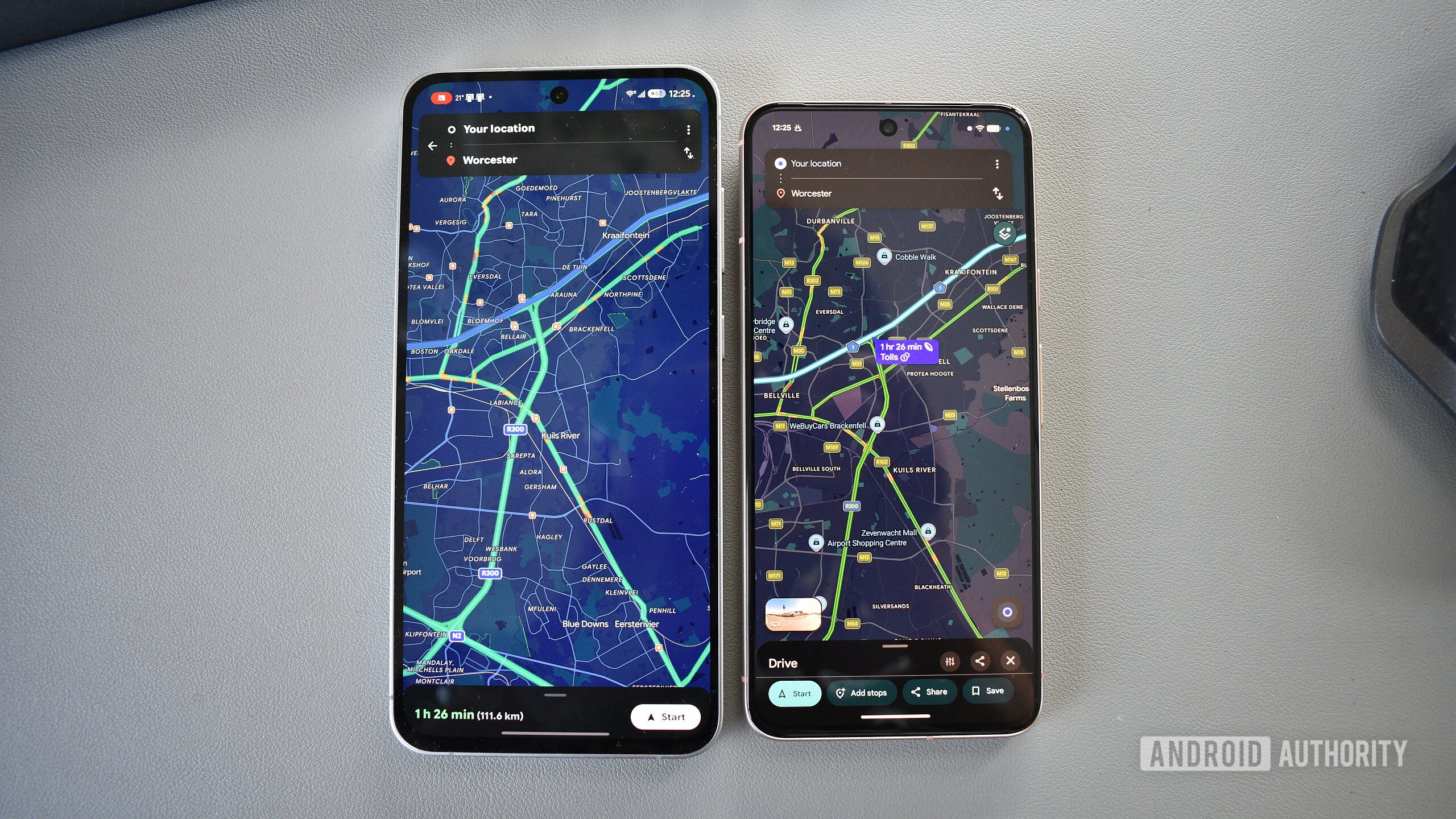
Vela Maps distinguishes itself by building upon OpenStreetMap (OSM) as its foundational mapping data source. OpenStreetMap is a collaborative project to create a free, editable map of the world, contributed by a global community of mappers. This open-source base ensures transparency and community ownership, contrasting sharply with the proprietary nature of Google’s mapping data. What makes Vela Maps particularly innovative is its ability to overlay user-requested Google Maps data on top of the OSM base. This hybrid approach allows Vela to tap into some of the rich information Google Maps provides (such as points of interest, reviews, and images) while maintaining its core independence and offering users granular control over what data is accessed and when.
The user interface (UI) of Vela Maps is a testament to its developer’s strategic vision. Upon launching the application, users are immediately struck by its strong resemblance to Google Maps. This isn’t accidental; it’s a conscious design choice aimed at leveraging existing user muscle memory and minimizing cognitive load during navigation. While other open-source mapping applications like OsmAnd or Organic Maps offer powerful features, their UIs often diverge significantly from mainstream expectations, creating a steeper learning curve. Vela Maps, conversely, seeks to provide a seamless transition for users accustomed to Google Maps, translating familiar layouts and functionalities into its independent framework.
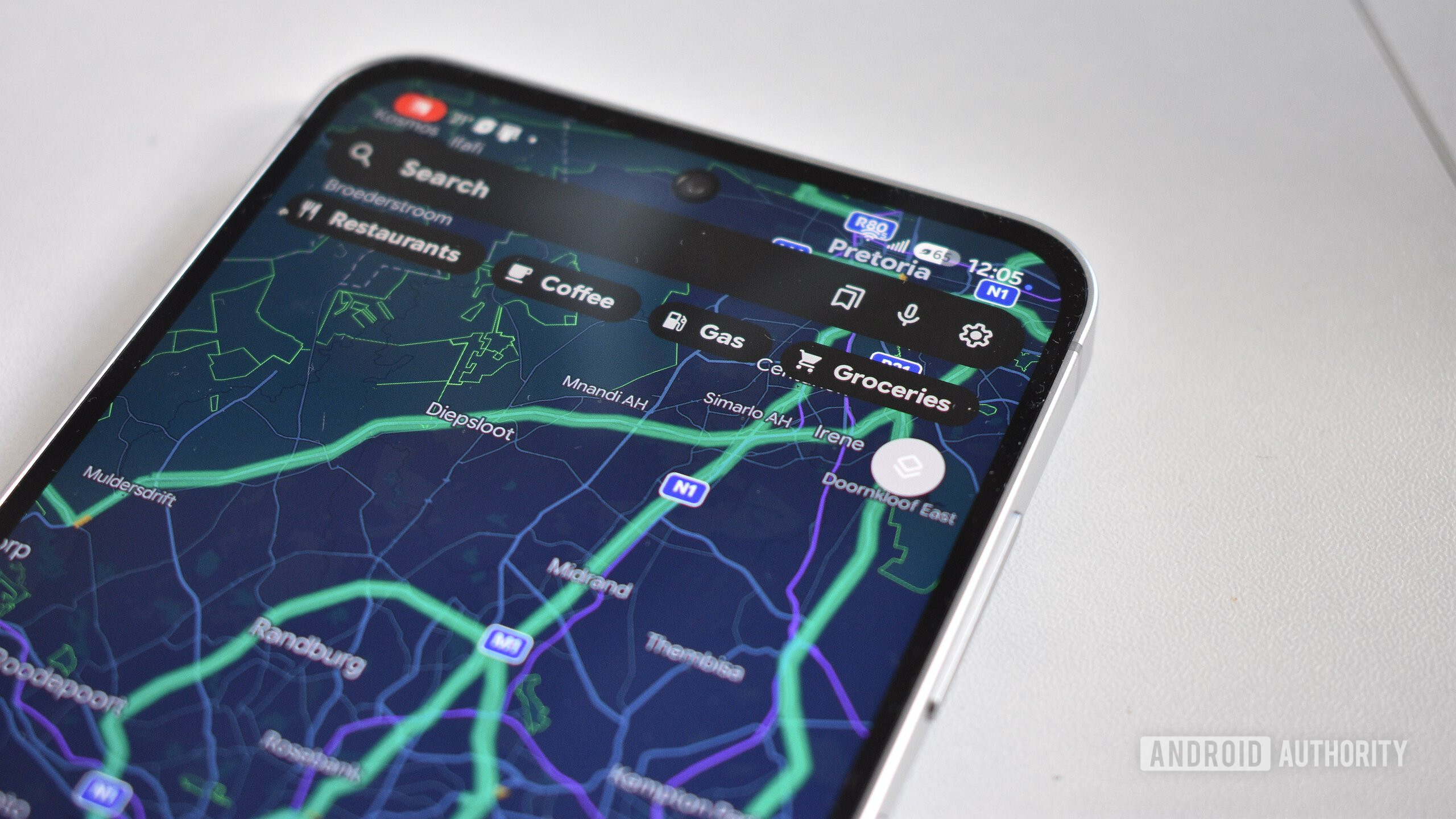
Despite the intentional similarities, Vela Maps introduces several thoughtful UI enhancements. The Search bar, for instance, provides direct access to "Lists" of favorite or frequented places, which can even be imported from Google Maps via Google Takeout. This immediate accessibility is a notable improvement over Google Maps’ more layered approach. Another practical addition is a "P" button on the home screen, allowing users to quickly save their parking spot with a single tap. While Vela Maps currently omits the dynamic "Local vibe" data found in Google Maps’ bottom flyout menu—a feature that provides community-generated insights into establishments—it compensates with a cleaner, more focused approach to points of interest (POI). Search chips for categories like "Restaurants," "Coffee," "Gas," and "Groceries" present results within the map area without sponsored listings, and photos/reviews only load upon explicit user consent, promoting a less cluttered and more privacy-conscious browsing experience.
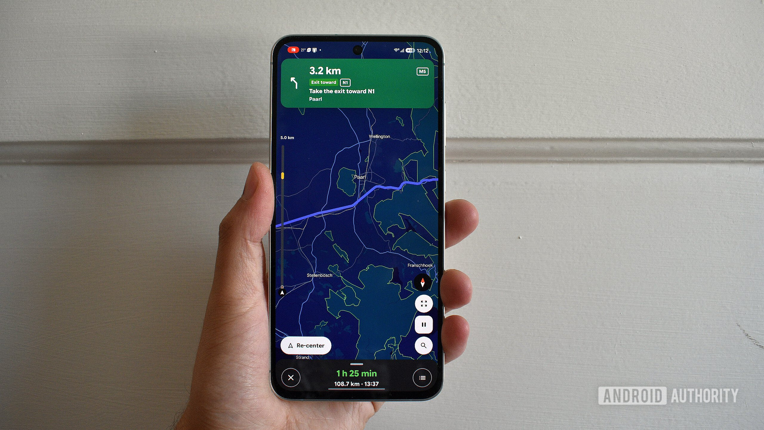
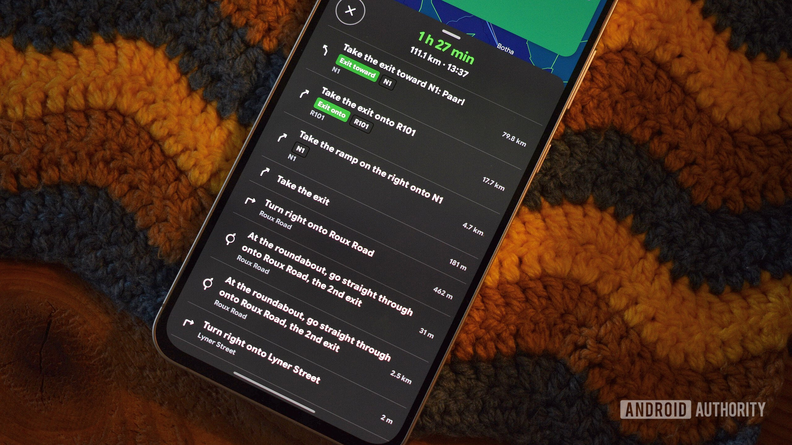
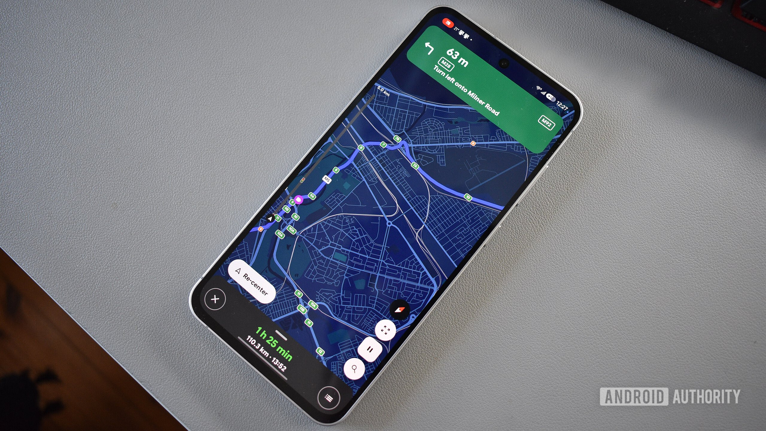
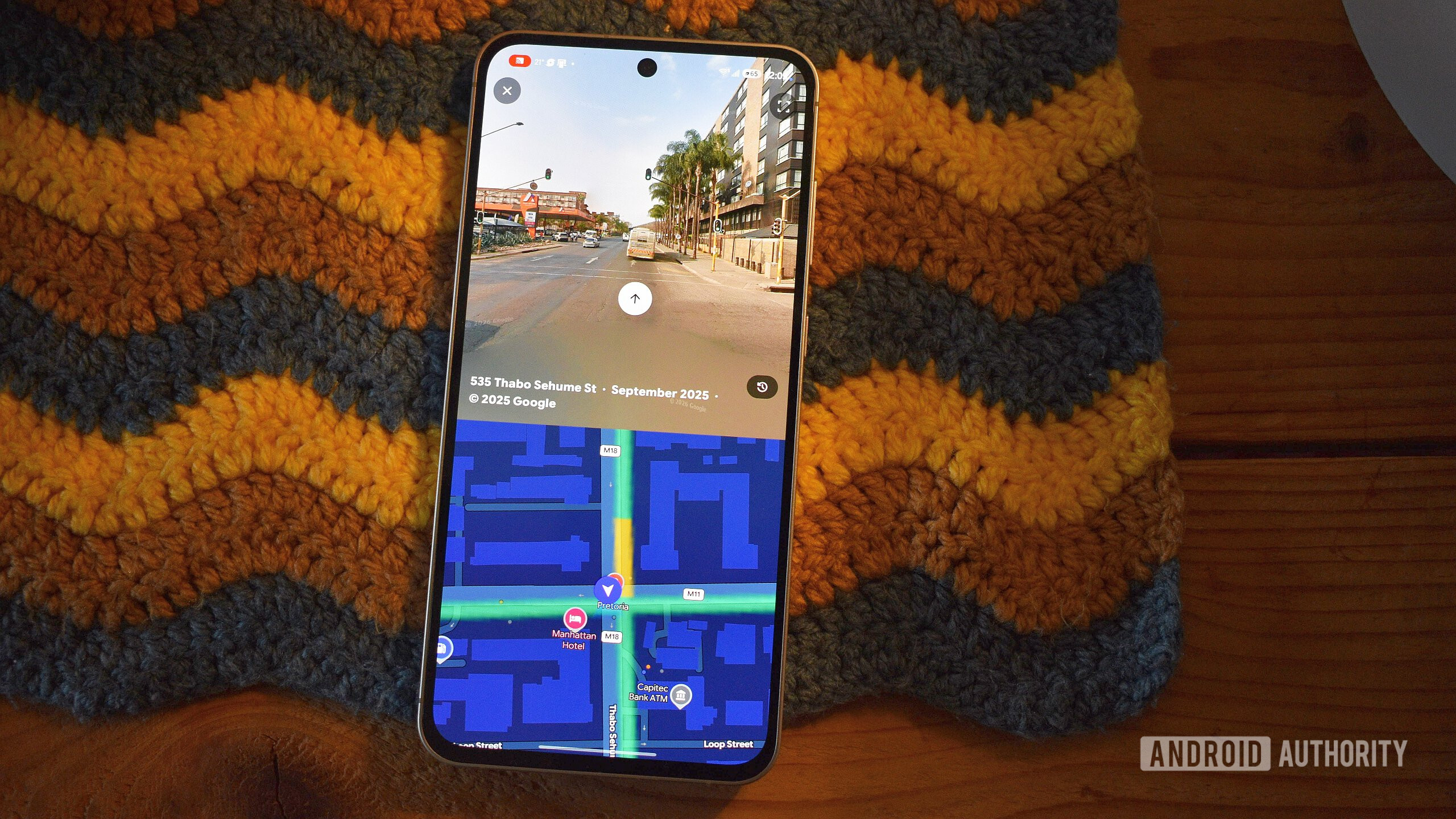
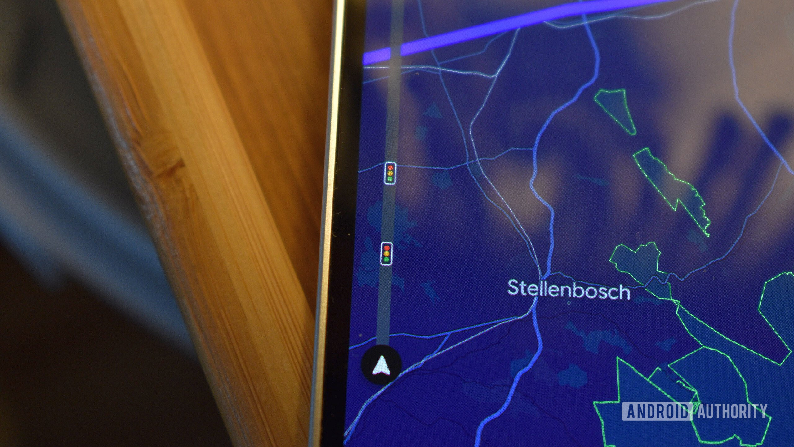
Furthermore, Vela Maps integrates Google Street View functionality, albeit with a less fluid execution than the native Google Maps application. This inclusion, however, remains a valuable asset for users on de-Googled devices who otherwise would lack access to street-level imagery for route planning or reconnaissance. In terms of active navigation, Vela Maps introduces a highly practical "Road ahead bar" that offers a vertical preview of traffic and other critical information along the upcoming route. This feature provides a proactive awareness of road conditions beyond the immediate map view, a capability that could significantly enhance the user experience in Google Maps itself. The application also boasts a more legible speedometer display, utilizing a bold, contrasting red-on-white dialog for current speed and speed limits. This commitment to clear, flat, and contrasting design elements suggests a superior implementation of Material 3 Expressive principles, contributing to a more readable and less distracting interface, particularly crucial during driving.
Installation and Ecosystem Independence
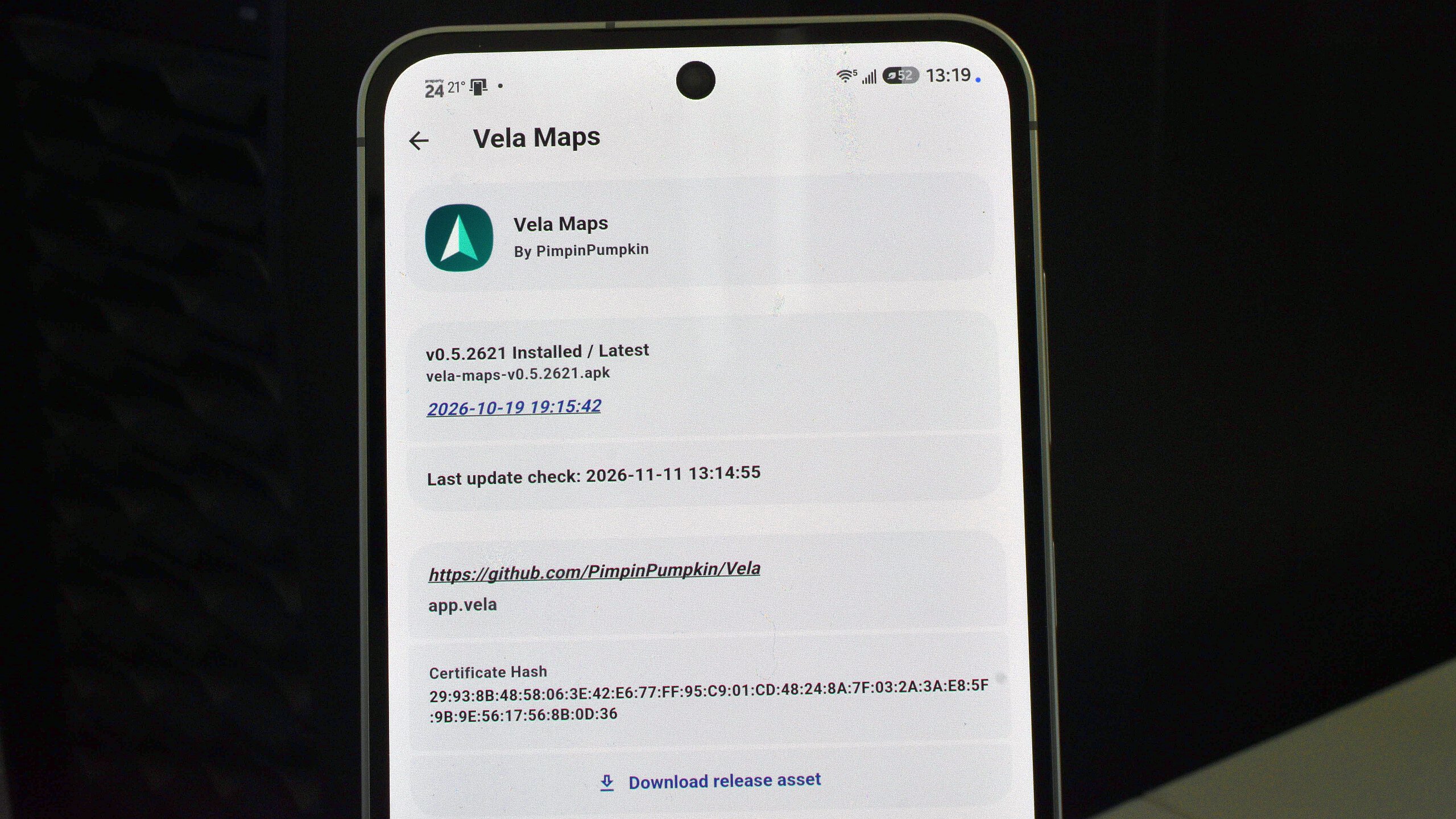
Vela Maps’ commitment to independence extends to its distribution model. As it is designed to function without Google Mobile Services and prioritizes user privacy, it is not available through the conventional Google Play Store. This necessitates alternative installation and update methods, which might initially present a minor hurdle for users accustomed to one-click app management. The recommended approach for installing and maintaining Vela Maps is through third-party app updaters like Obtainium. Obtainium streamlines the process by fetching APKs directly from the project’s GitHub repository and initiating periodic update checks, ensuring users always have the latest version. This method underscores the app’s open-source nature and its reliance on community-driven distribution channels, further decoupling it from Google’s ecosystem. For those wishing to simply test the application, direct download of the APK from the Vela Maps GitHub repository remains an option. This independent distribution model is a cornerstone of its privacy-focused identity, allowing users to install and manage the app without Google’s intermediation.
Key Differentiators and Advantages for the Discerning User
Beyond its UI and technical foundation, Vela Maps offers several compelling advantages that set it apart from its proprietary counterparts. The extensive customization options within its "Settings" page are a standout feature. Unlike Google Maps, which often presents a curated and less flexible experience, Vela Maps empowers users with granular control over nearly every aspect of the application. This includes the ability to download full country maps for offline navigation—a crucial feature for travelers in areas with unreliable cellular coverage, leveraging the comprehensive nature of OpenStreetMap data. Users can also fine-tune map appearance, color schemes, button layouts, icon sizes, and even performance tweaks.
Perhaps the most significant advantage for privacy-conscious users is Vela Maps’ transparent and controllable integration with Google services. While the app can access Google Maps data for certain functionalities, it meticulously logs every request made to Google, detailing its purpose and allowing users to restrict specific data loads. This unprecedented level of transparency and control over data interaction is a stark contrast to the black-box nature of many proprietary applications. Users can opt to run Vela Maps entirely without any Google tie-ins, cementing its position as a truly independent and privacy-respecting navigation tool. The fact that Vela Maps is generally swifter and lighter than Google Maps, even while offering comparable core functionality, further enhances its appeal, especially for devices with limited resources or users seeking a streamlined experience.
Current Limitations and Future Development Outlook
Despite its impressive features and strong conceptual foundation, Vela Maps remains a project in its beta phase, partially developed with AI assistance. This status implies that occasional bugs, feature inconsistencies, and ongoing development are to be expected. One of the most significant limitations at present is the unreliable support for Android Auto. While workarounds and experimental integrations exist, achieving consistent and stable functionality on car head units remains a challenge. This deficiency is a critical hurdle for many users who rely on seamless in-car navigation, and its absence forces drivers to use phone holders, potentially compromising safety and convenience.
Another area where Vela Maps currently falls short is the absence of a robust community interaction layer, a cornerstone of Google Maps and Waze. Users cannot upload photos, submit reviews, or report real-time road conditions and obstructions directly within Vela Maps. Google Maps often leverages Waze data for incident reporting, providing dynamic traffic and hazard alerts that are crucial for long-distance drivers. Without this collaborative data input, Vela Maps’ real-time information on road conditions, accidents, or police presence is limited. While its OpenStreetMap base is community-driven, the application itself does not yet facilitate direct, real-time user contributions for dynamic road events. The potential for integrating unique OpenStreetMap data, such as detailed road surface information (e.g., paved vs. unpaved roads, a feature lauded in applications like OsmAnd), also remains largely untapped but represents a promising avenue for future development.
The Broader Landscape of Digital Navigation
Vela Maps’ emergence is not in a vacuum. It reflects a growing demand for diverse navigation solutions that cater to specific user needs, particularly those related to privacy, open-source principles, and system independence. The global navigation app market is vast and competitive, with Google Maps holding a dominant position, followed by Apple Maps, Waze, and a host of regional players. However, the rise of "de-Googled" Android distributions like GrapheneOS, CalyxOS, and LineageOS, driven by increasing public awareness of data privacy, has created a niche for applications that can function effectively outside the Google ecosystem.
Other open-source alternatives like OsmAnd and Organic Maps have long served this community, offering offline mapping, extensive customization, and strong privacy features. Yet, these apps often present a steeper learning curve or a less polished user interface compared to Google Maps. Vela Maps attempts to bridge this gap by offering a familiar user experience while adhering to open-source principles. Its hybrid approach—using OpenStreetMap as a base while selectively accessing Google Maps data with user consent—represents a pragmatic solution for users who want the best of both worlds: robust data and privacy control. The ongoing development of AI-assisted coding also signifies a potential paradigm shift in how open-source projects can accelerate their growth and feature development, potentially enabling smaller teams to compete more effectively with well-resourced corporate entities.
Future Prospects and User Considerations
For users operating on "Googled" Android devices, the decision to switch from Google Maps to Vela Maps currently involves a trade-off. While Vela offers enhanced privacy, greater customization, and a lighter footprint, it lacks the polished stability, comprehensive real-time community data, and ubiquitous Android Auto integration that characterize Google Maps. The beta status of Vela Maps means users must be prepared for occasional bugs and evolving features. Google Maps, as a mature product, offers a highly refined and integrated experience within the Google-developed OS.
However, for the de-Google community, GrapheneOS users, or anyone deeply concerned about data privacy and seeking an open-source alternative that doesn’t compromise on user experience, Vela Maps is undeniably a superior choice. It offers a near one-to-one functional and aesthetic replacement for Google Maps without the need for Google Mobile Services. The app’s swift performance and unique navigation enhancements, such as the "Road ahead bar" and highly legible speedometer, provide genuine improvements over the incumbent.
As Vela Maps continues its development, achieving a stable release and reliable Android Auto support will be critical milestones in its journey to becoming a mainstream alternative. Expanding its community-driven data features, perhaps by integrating more directly with OpenStreetMap’s rich, diverse data beyond basic mapping, could further enhance its value proposition. Ultimately, Vela Maps stands as a promising example of how innovation, user-centric design, and a commitment to privacy can challenge established norms in the digital landscape, potentially evolving into a truly better overall navigation product for a growing segment of discerning users.